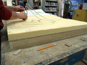
Today in the shop our model makers are carving foam. That can only mean one thing – besides a mess – a topography model! A topography model depicts the 3D nature of a particular terrain, accurately recording elevation levels and identifying specific land forms.
A topography site plan is used for this project.
The site plan is then transferred to a foam block for carving. While in the past topographic models were layered up, using cork, mat board or foam core, modern techniques use the opposite process. Starting with a foam block, the relief is then carved out of the solid piece with a router. The depth that the router plunges into the foam is determined by the scale being used on the map. Different colored lines on the map represent different elevations. Once the routing is complete the different steps created in the foam are then sanded down to make a smooth transition in elevation levels.
The foam will then be painted, roads glued down and the remaining surface flocked.


